Garmin
Descent X50i
A comprehensive technical review: dive modes, 7 customized screens, SubWave, S1 smart buoy, inReach, mapping, battery performance and hands-on findings.
My hands-on assessment of the X50i, from configurable dive displays and technical functions to the maps I use for exploring dive sites.
Read full review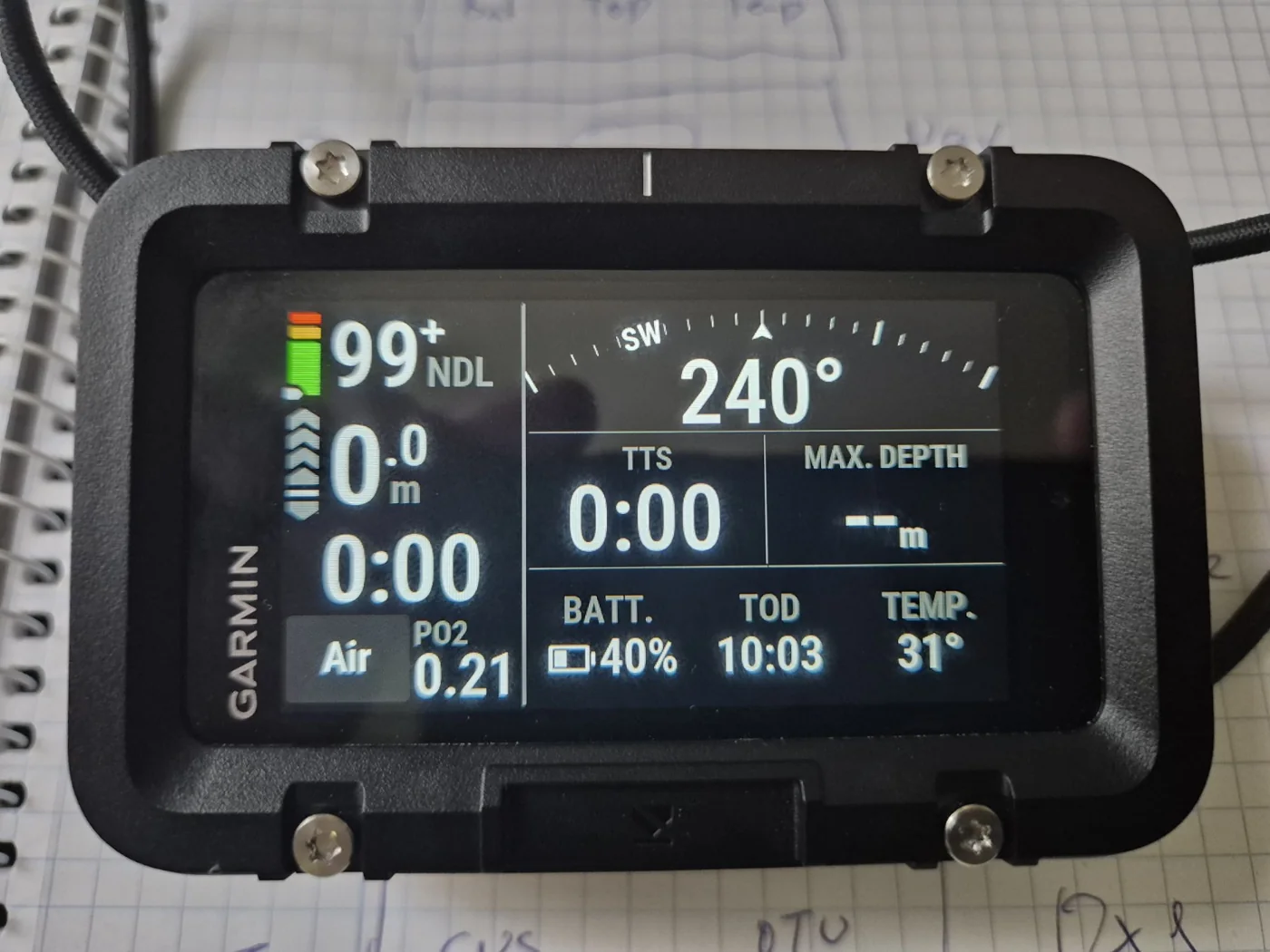
1. The X50i in Perspective
Introduced in 2024, the Garmin Descent X50i is a dedicated large-format dive computer, not a general-purpose smartwatch. It combines a large touchscreen, leakproof physical buttons, Bühlmann ZHL-16C decompression, multi-gas and closed-circuit rebreather support, GPS navigation, DiveView bathymetric charts and an optional SubWave acoustic network.
I have explored the X50i’s menus, maps, custom displays and Garmin Dive connectivity extensively. The underwater messaging system, T1/T2 tank transmitters, S1 smart buoy and extended underwater battery endurance remain to be tested.
2. Construction, Display and Controls
| Specification | Published / observed value |
|---|---|
| Display | 3.0-inch colour LCD touchscreen, 640 × 360 |
| Housing and lens | Fibre-reinforced polymer body; sapphire crystal |
| Dimensions / weight | 62.4 × 98.3 × 24.5 mm; approximately 253 g without straps |
| Water / dive rating | 20 ATM; rated for diving to 200 m |
| Algorithm | Bühlmann ZHL-16C with configurable gradient factors |
| Storage | 32 GB internal |
| Navigation | GPS, GLONASS, Galileo; digital compass |
| Connections | Bluetooth, Wi‑Fi, ANT+ and SubWave with compatible additional devices |
The housing feels substantial and robust. The physical inductive buttons are well suited to wet conditions and gloves. The touchscreen is convenient above water for menu navigation, map panning and configuration; underwater operation relies on the physical controls.
The X50i is large and relatively heavy, but the tradeoff is a broad, clearly organized display that can carry considerable technical information. The Suunto Nautic has a slightly larger nominal screen; the X50i’s principal advantage is its flexible information layout.
3. Dive Modes and Gas Handling
| Mode | How it is used |
|---|---|
| Single-Gas | Air or Nitrox with one primary gas plus optional contingency gas entries. |
| Multi-Gas | One designated bottom gas and additional travel, deco or backup mixtures; supports Trimix. |
| CCR | Two configured oxygen setpoints, diluent gas selections and OC bailout/decompression gases; setpoint-based calculation, not live cell monitoring. |
| Gauge | Depth and timing information without decompression guidance; post-Gauge restrictions apply. |
A particularly useful organizational feature is the distinction between decompression gases, which the X50i can consider in planned TTS, and backup gases, which are excluded from predicted use until selected. This keeps an emergency reserve from being silently incorporated into the normal ascent schedule.
During a dive the diver can manually choose the actual breathing mixture. Predicted decompression updates with the selected gas and depth history; a saved decompression plan is not a rigid script. Every physical gas change still requires verification of mixture, operating depth and supply.
4. Decompression Information and Planning
The Bühlmann ZHL-16C implementation offers custom gradient factors, NDL, TTS, decompression ceiling, GF99, SurfGF, tissue-loading graphs, CNS and OTU information. The on-device planner supports conventional OC multi-gas profiles, but not a complete variable-depth cave or expedition sequence.
Two useful predictive fields are TTS @+5, the projected time to surface after another five minutes at the present depth, and TTS Δ+5, the predicted increase in TTS. The computer also offers NDL-oriented depth-change fields; these should not be confused with a TTS prediction at a different depth.
For my planned configurations, I use GF 85/85 as a recreational air/Nitrox starting point, while evaluating 45/85 for more technical decompression profiles. These are individual preferences rather than universal prescriptions.
5. Seven Custom Dive Displays — My Configuration
I confirmed directly on my X50i that seven freely configurable dive pages are available per dive mode. An optional predefined Diver Dashboard can be added, but it is not an eighth fully customizable page. Here is how I have arranged my seven displays.
| Page | Data and role |
|---|---|
| 1 — Standard | NDL, depth, dive time, gas and ppO₂, compass heading, TTS, max depth, battery, temperature and clock. |
| 2 — Compass | Large 360° compass rose and numerical heading while the fixed dive-data band remains visible. |
| 3 — Dive Profile | Depth-history graph, maximum depth and TTS. |
| 4 — GF & Ascent | GF99, SurfGF, TTS and ascent rate, with heading. |
| 5 — Oxygen & Tissues | Gas ppO₂, CNS, OTU, raw tissue graph and stopwatch. |
| 6 — Stops & Ceiling | Current depth, safety stop, time at stop, ascent rate and raw ceiling. |
| 7 — Predictions | TTS @+5, TTS Δ+5, GF99, SurfGF, GF conservatism and raw ceiling. |
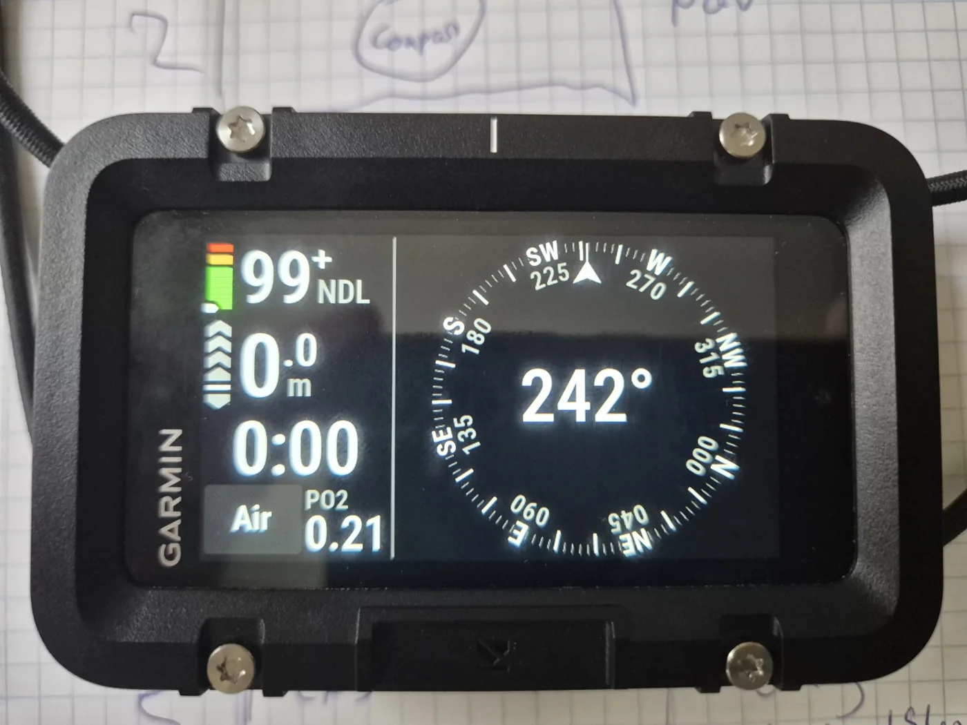
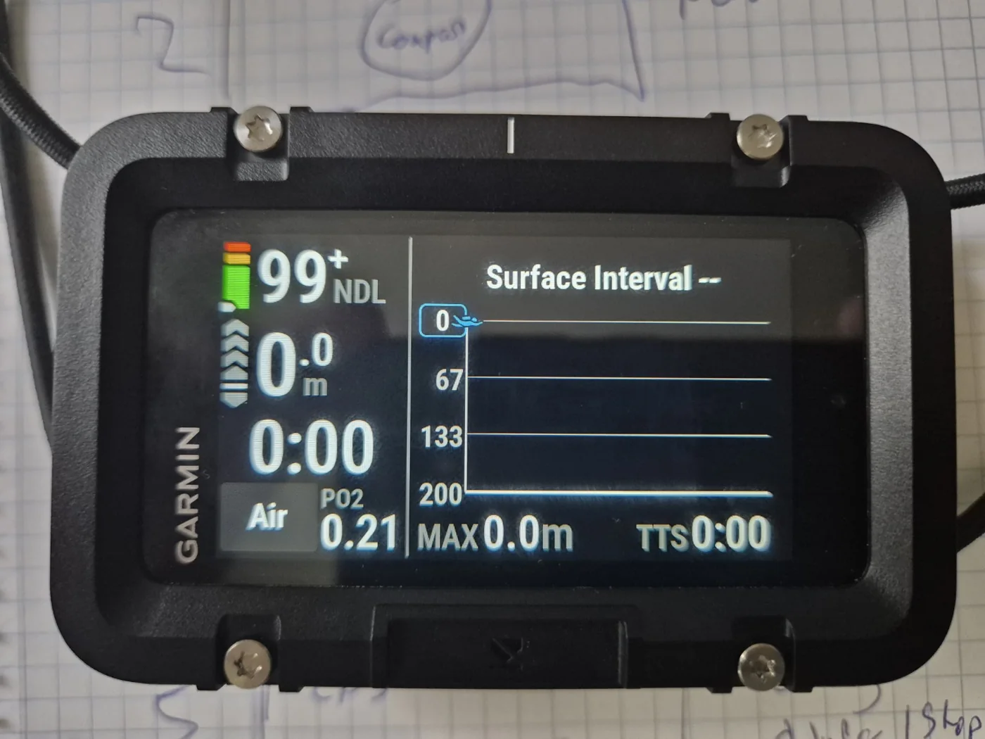
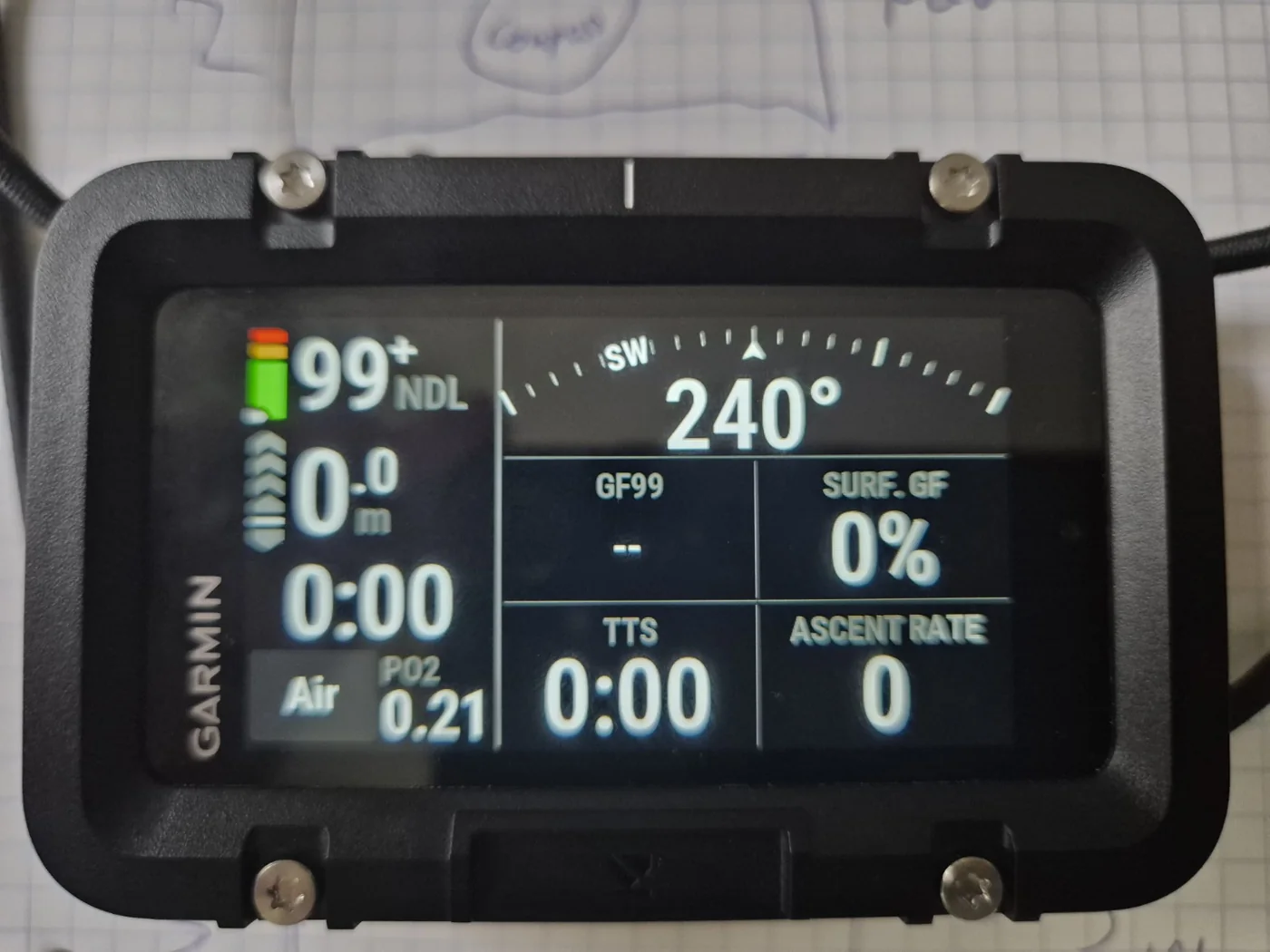
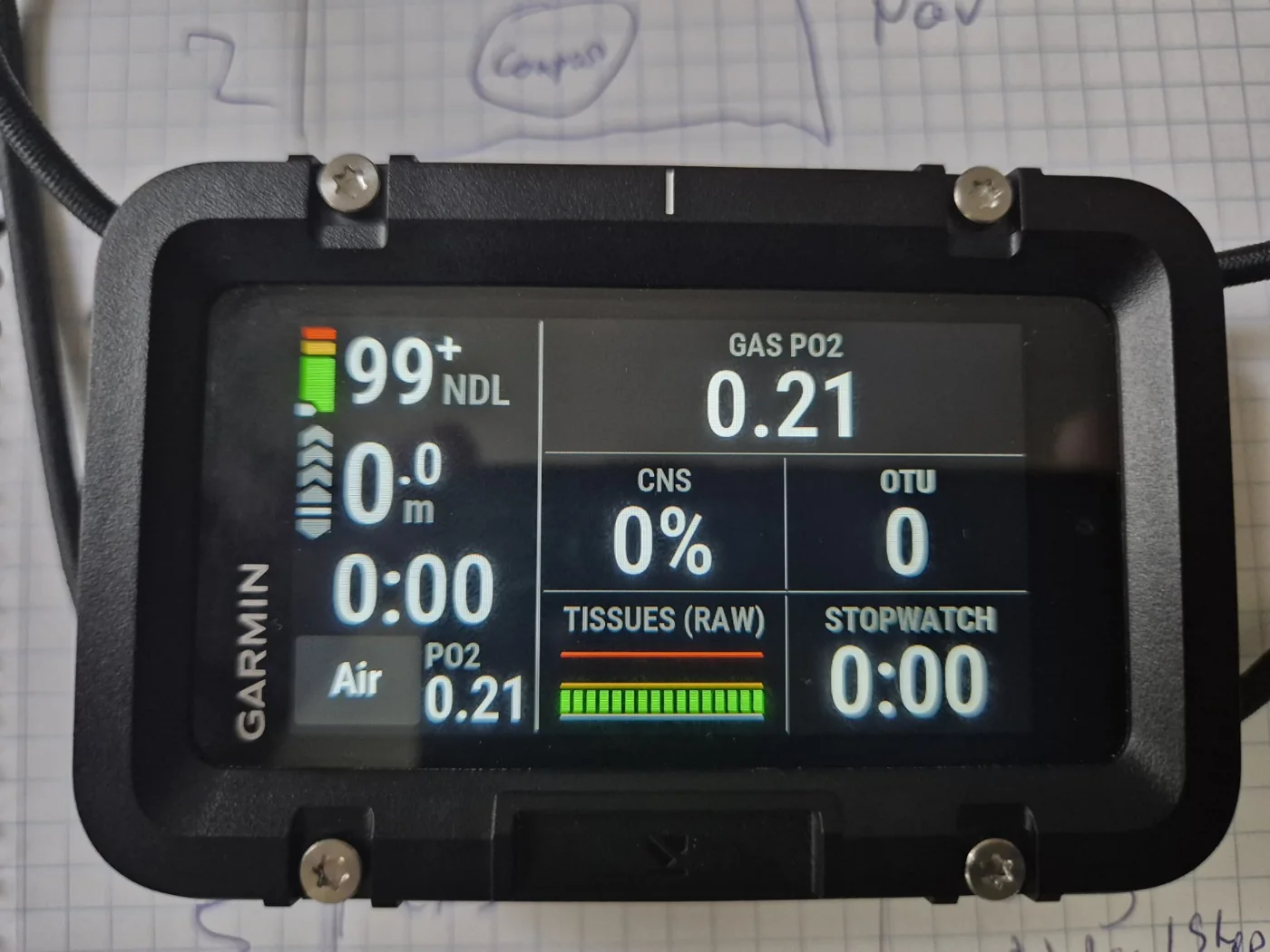
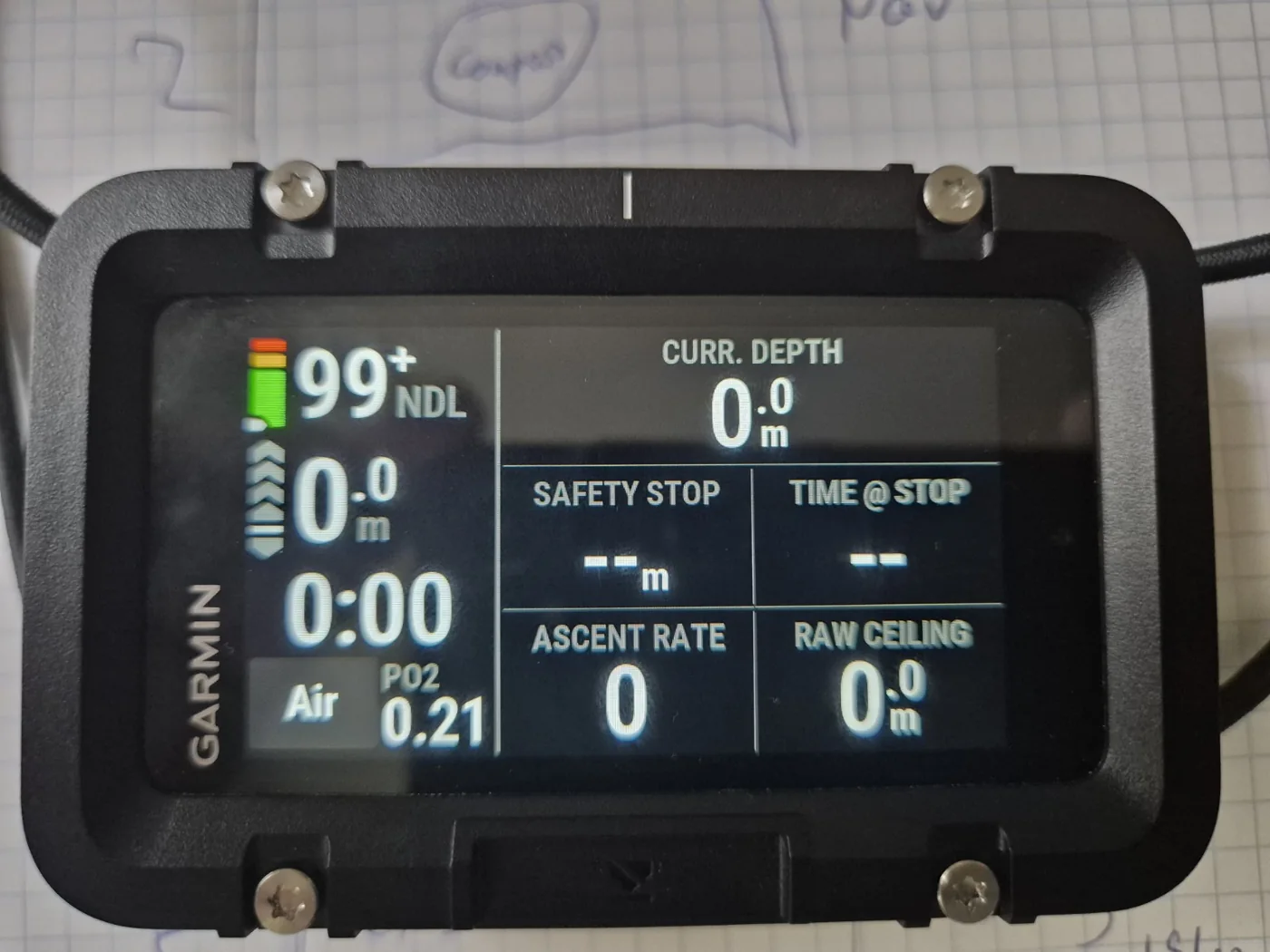
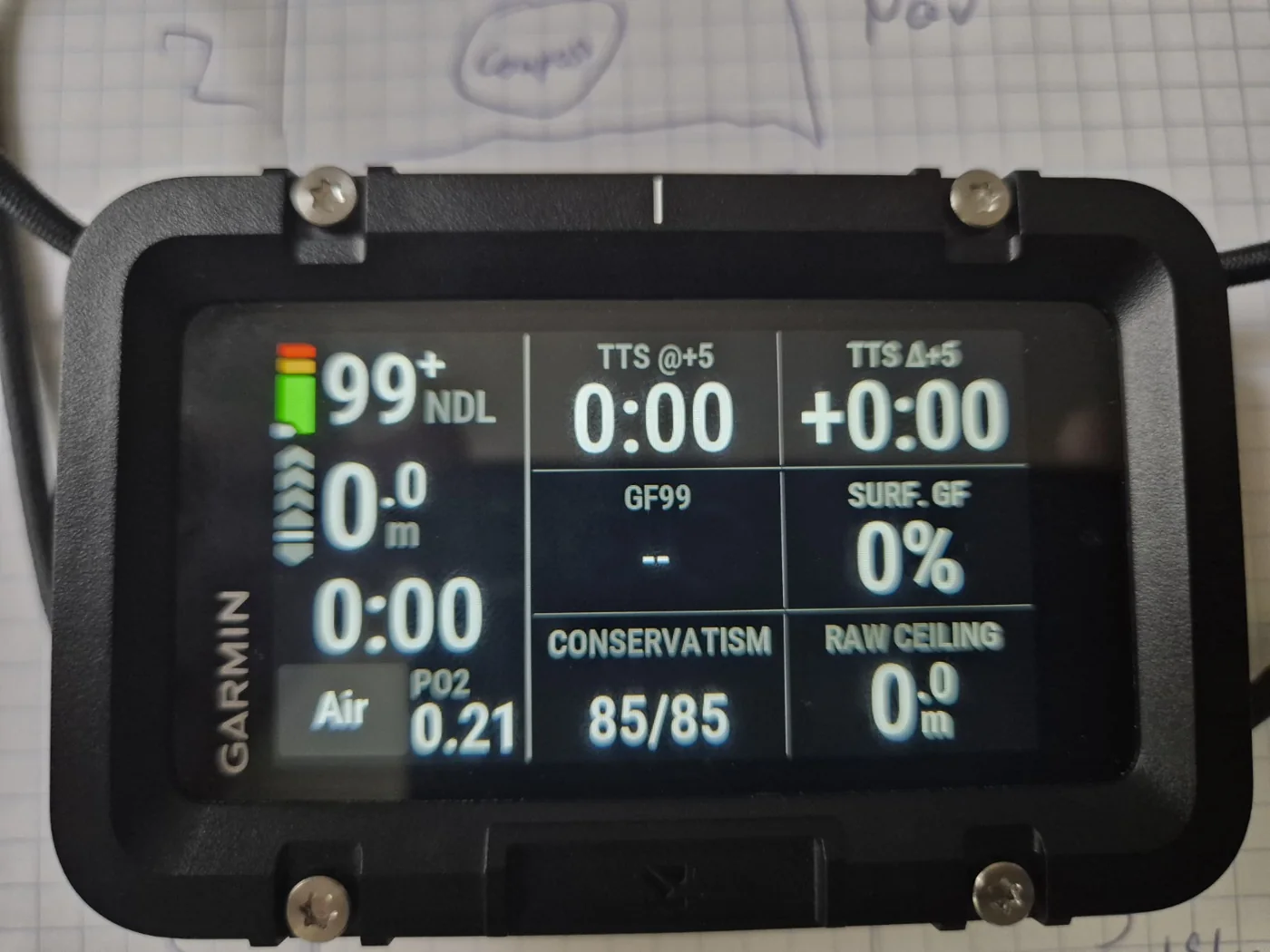
The pages progress from everyday dive information and navigation to oxygen exposure, decompression execution and predictive calculations. Their purpose is not to show every number simultaneously but to make related data easy to find.
6. SubWave: Acoustic Communication and T2 Transceivers
Water strongly attenuates conventional radio communication. Garmin’s SubWave system instead carries short digital messages and diving data using acoustic sonar signals. With compatible Descent T2 equipment, the X50i can exchange preset underwater text messages with individually addressed teammates or a group of up to eight networked divers.
| Capability | Garmin-stated range / requirement |
|---|---|
| Pressure, diver depth and distance | Up to 10 m using compatible transmitters |
| Preset diver-to-diver messaging | Up to 30 m with compatible T2 transmitters |
| S1 buoy-assisted messaging / tracking | Up to 100 m in supported conditions |
| T2 transmitter battery | CR123A lithium; up to 100 hours stated |
| Group messages | Up to eight networked divers |
Presets include simple instructions, status reports and attention signals. They are not unrestricted spoken or typed conversations underwater. Messages require suitable acoustic connectivity and may be delayed by obstacles, depth, surf conditions and equipment orientation.
I have not yet used a T1/T2 transmitter underwater, so I cannot personally assess message delivery, latency, tank-pressure accuracy or acoustic range. The figures above are Garmin’s published specifications.
Acoustic chirping: Garmin acknowledges an audible sonar chirp from the transmitters. Some divers may find repetitive electronic sounds intrusive, especially on quiet observation dives. This is a potential subjective disadvantage, not a personally tested noise complaint.
7. Descent S1 Smart Buoy — Dive Teams, Charter and Expedition Use
Garmin’s Descent S1 smart buoy extends the SubWave system beyond a local buddy network by acting as an acoustic reference and relay between submerged divers and a supporting team at the surface. It is particularly relevant to professional dive operations, instructional groups, charter boats, commercial-style monitoring workflows and expedition teams.
| Feature | Garmin description |
|---|---|
| SubWave relay | Extends compatible messaging and monitoring up to 100 m from the buoy, subject to conditions |
| Surface monitoring | Garmin Dive app can show approximate diver positions, depth and cylinder-pressure data when paired equipment is present |
| Topside messaging | Surface support can exchange preset messages and recall divers with compatible hardware |
| Find My Buoy | Compatible divers can see distance and direction back to the buoy |
| Review | After-dive spatial heat-map information can be displayed in Garmin Dive |
| Battery | Up to 15 hours, manufacturer estimate |
| Surface link | Wi‑Fi to a compatible smartphone/tablet, stated range up to 60 m |
| Original announced US MSRP | $2,499.99 (July 2025) |
Potential applications include coordinating multiple divers over a reef, monitoring training groups from a boat, supervising search-and-recovery teams, and coordinating an expedition with surface personnel. These are operational examples, not proof of suitability or certification for safety-critical commercial use.
The S1 is not a lifeline, rescue system, precise underwater GPS or replacement for primary dive-team procedures. Garmin warns that hulls, rocks, kelp, reefs and surface conditions can reduce range or block communication. For best results it should have unobstructed acoustic geometry to the divers below.
I have not yet used the S1 buoy. The operating ranges and functions described above are based on Garmin’s specifications.
8. DiveView Mapping — The Strongest Surface Feature
The integrated DiveView maps show dive-site markers, undersea contour lines, depth shading and selected seafloor features. Garmin’s preinstalled regional coverage is principally the USA, Europe and northern Africa, including the Mediterranean and northern Red Sea. The enhanced regional packages must be selected according to the device.
For the X50i, the optional Extended Coverage map (part number 010-D2276-00) expands coverage to Southeast Asia, the Caribbean, Central America, Mexico, Oceania and Indian Ocean regions, with geographic exclusions. Garmin confirms the X50i is the target device for this expansion.
On my X50i, Extended Coverage added detailed locations around Mabini, Anilao, Eagle Point and Koala Reef in the Philippines. The closely spaced depth contours near the shallow reef in front of Eagle Point indicate a steep offshore drop toward approximately 80 m, beyond the area where my wife and I snorkeled.
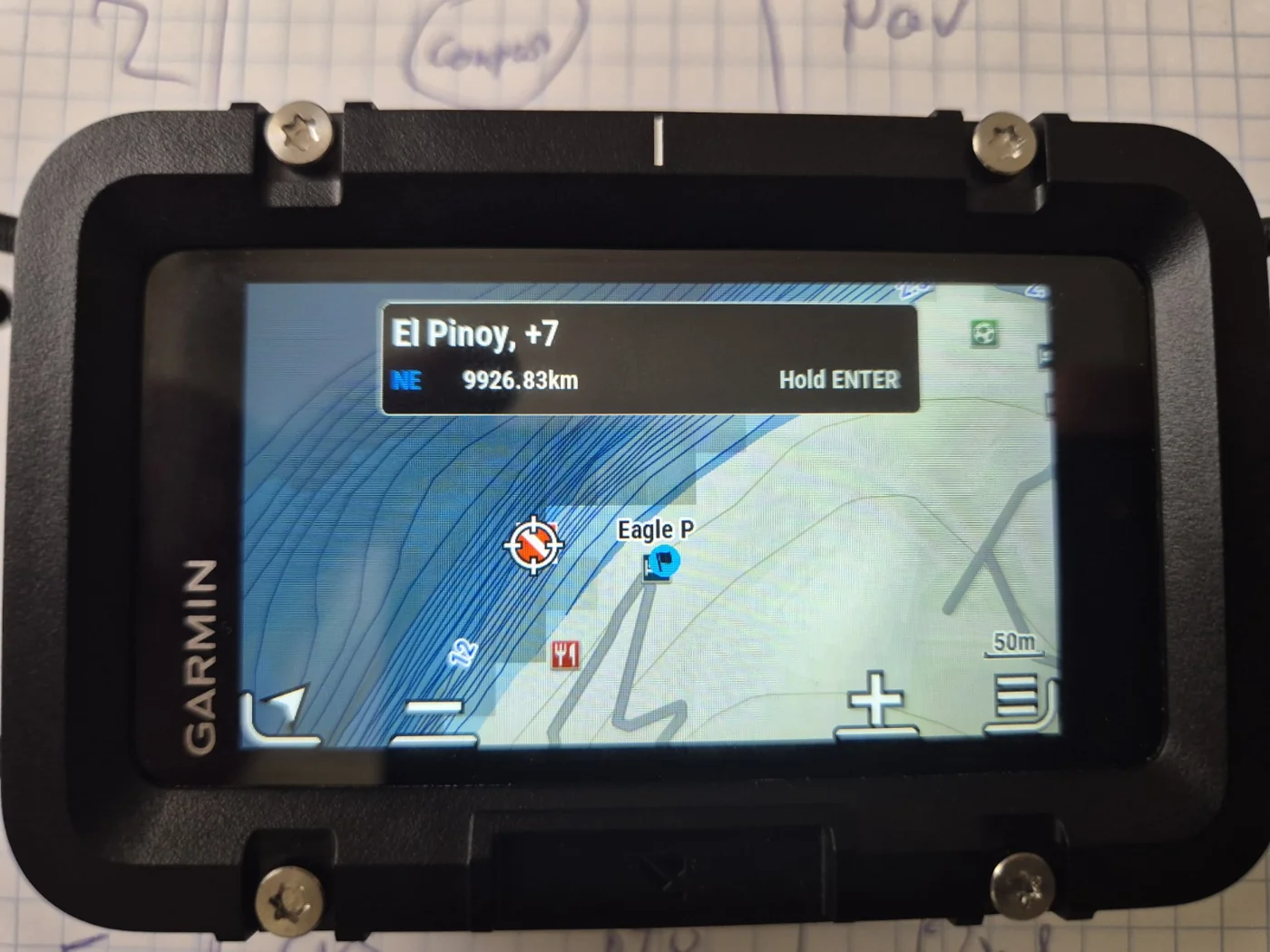
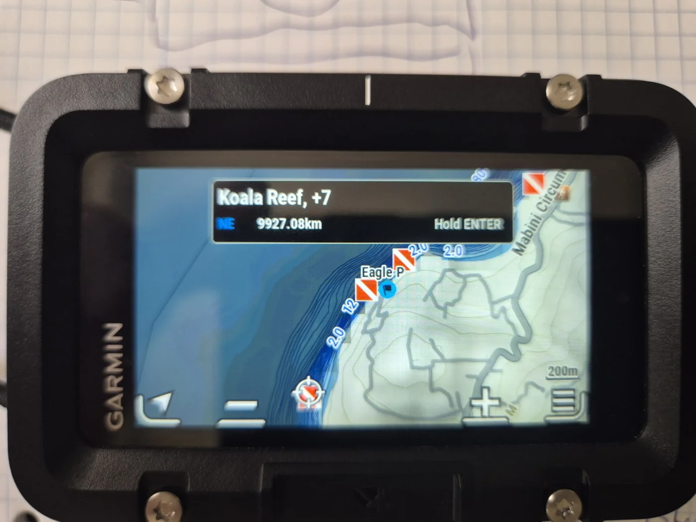
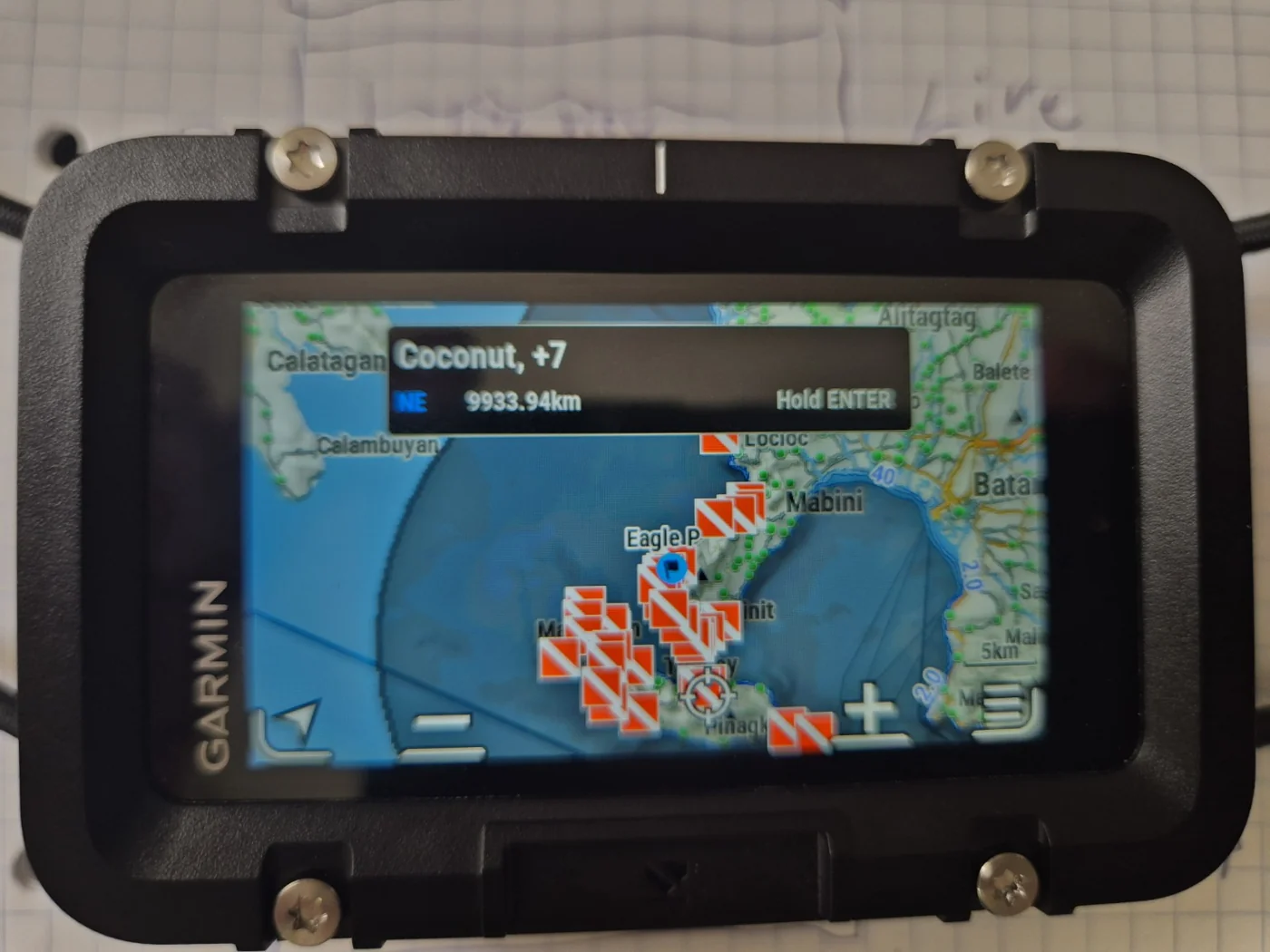
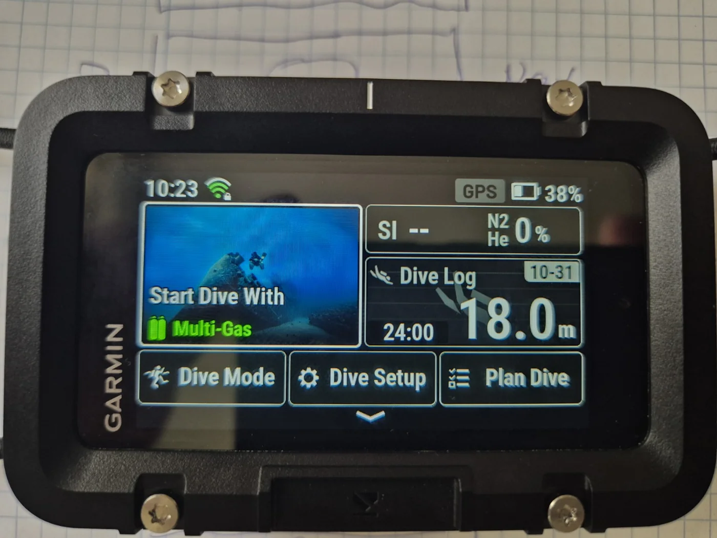
These maps are a surface reconnaissance aid. Garmin says DiveView maps are viewed on the surface; they do not provide real-time submerged GPS positioning. The contour detail is not a substitute for site-specific survey information, current conditions or local diving knowledge.
9. An Important DiveView Purchase and Installation Experience
Garmin sells both Full Coverage (010-D2286-00) and Extended Coverage (010-D2276-00). The names can easily mislead a customer who assumes the larger Full Coverage product is the correct X50i expansion.
I first purchased the roughly €70 Full Coverage download. Garmin showed the order as fulfilled, but it did not appear in Garmin Express under purchased content for the registered X50i. Refreshing, signing in and other routine steps did not resolve it.
After purchasing the roughly €35 Extended Coverage package, it appeared immediately in Garmin Express and installed successfully, delivering the desired Philippine bathymetric contours. Garmin’s online product description specifically directs existing X50i owners to the Extended Coverage product.
10. GPS, Waypoints, Weather and Tides
Above water, the X50i offers GPS positioning, waypoint management and multiple map views. The 3D compass is available as a dedicated navigation display. The available application menu also includes weather and tidal information.
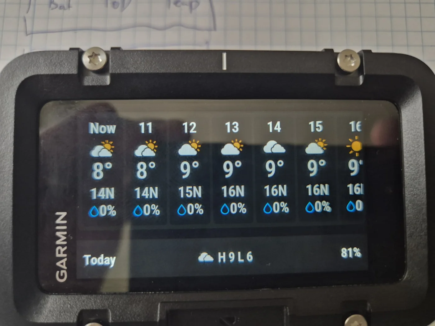
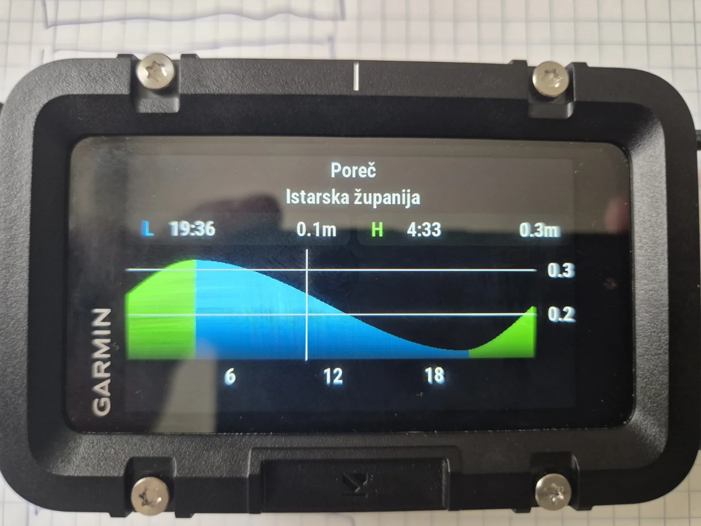
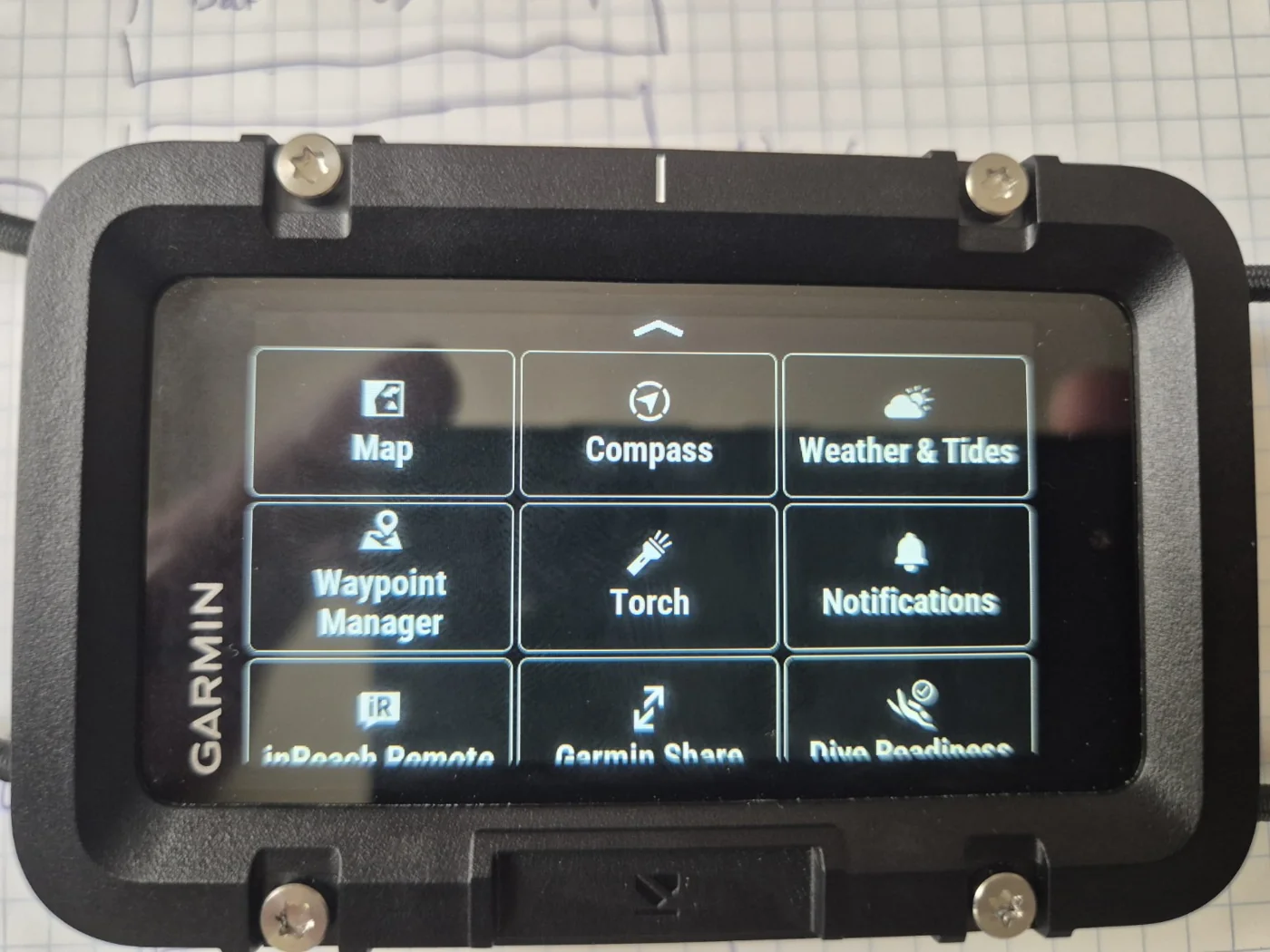
GPS reception is a surface function and does not follow the diver underwater. Tide and forecast data are supporting information, not substitutes for local marine observations.
11. Garmin Dive, Express and inReach
Garmin Dive is the main smartphone companion for dive-log synchronization, profiles, photos and additional notes. I find app connectivity and everyday use very good, although occasional UI inconsistencies exist—such as bathymetric label units not always matching the selected metric setting.
Garmin Express on a Windows or Mac computer manages device firmware and map downloads. This is the installation path for purchased DiveView Extended Coverage, not a file that users normally copy manually.
The X50i also provides inReach Remote functionality with compatible inReach communicators. I also own an inReach Mini 3 Plus; the remote function is a useful ecosystem capability for satellite messaging, preset messages, tracking and SOS control where pairing, subscription and satellite visibility permit. I have not yet tested this exact pairing.
The X50i itself is not a satellite communicator; underwater radio connectivity to an inReach device and satellite contact through water must not be assumed.
12. Battery Endurance — The Main Criticism
| Garmin dive-mode estimate | Duration |
|---|---|
| High-brightness display | Up to 13 hours |
| Medium brightness | Up to 16 hours |
| Night Dive setting | Up to 20 hours |
These manufacturer ratings are for defined operating conditions and are not equivalent to constant surface touchscreen, mapping, wireless and GPS activity.
With extensive use for map inspection, setup, navigation and exploring the device, my X50i needs charging approximately every second day. For an expensive dedicated dive computer this is inconvenient and is the biggest drawback observed so far.
That is not a controlled underwater runtime test. Charging behavior may differ sharply with actual dive duration, brightness and enabled functions.
13. Overall Assessment and Verdict
The X50i offers a distinctive combination of rugged build, convenient surface touchscreen, comprehensive dive modes, deep customization, detailed decompression information and excellent DiveView/GPS mapping. The integrated maps around Mabini have proved particularly useful for examining familiar reefs and prospective shore-diving terrain.
Garmin’s optional SubWave T2 network and S1 buoy give the X50i additional promise for coordinated diving, charter groups and surface-supported expeditions. The acoustic chirp and reliance on additional hardware are important qualifications. None of the underwater messaging, transmitter or buoy behavior has been personally field-tested for this review.
The smartphone link and Garmin Dive application are strong, while Garmin’s split desktop/mobile ecosystem and poorly explained map package selection could be clearer. Extensive use drains the battery fast enough to require frequent charging.
Sources and Review Disclosure
Technical specifications and stated communication ranges are drawn from Garmin’s documentation. My assessment of the interface, custom displays, maps and battery use is based on firsthand experience. I have not yet field-tested SubWave communication, tank transmitters, the S1 buoy or inReach Remote operation.
- Garmin — SubWave technology
- Garmin — SubWave transmitter FAQ
- Garmin — Descent S1 official announcement
- Garmin — S1 dive cautions
- Garmin — DiveView map coverage
- Garmin — DiveView Extended Coverage
- Garmin — X50i manual
- Garmin — T2 specifications
Independent owner review — DiverInterCom KCore Scuba, November 2026. Features and interface options may change with future firmware updates.